Littlestock Brook Natural Flood Management
Littlestock Brook Natural Flood Management
Award-winning project to reduce flood risk in a small, rural community through the creation of landscape features that store water flow during heavy rainfall, with wider benefits for biodiversity and people.
Nature-based intervention:
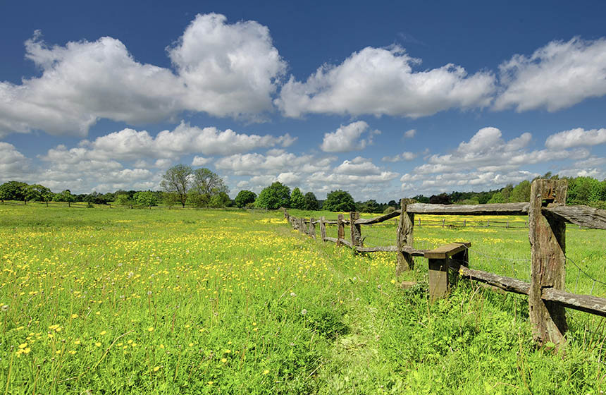
The Natural Flood Management project at Littlestock Brook aims to reduce flood risk in a small village, Milton-under-Wychwood, by diverting and storing water during heavy rainfall (1), with wider benefits for water quality, river habitat and people’s health and wellbeing (2). Interventions were conducted across 17 fields on the Bruern Estate and four in Fifield. Prior to implementation, hydraulic modelling and consultations with local communities were conducted to evaluate the effectiveness of interventions in reducing flood risk. This resulted in the creation of 15 low soil banks (bunds) in field corners that can temporarily store 30,000 m3 of flood water, along with 27 woody dams to regulate water flow, 14 nutrient retention ponds and 5 other ponds. In addition, 150m of stream was de-culverted and re-connected to its natural course. Because the stream is deeply incised, swales (trenches) have been dug to enable water to flow out of the stream and into the storage areas when the level rises. To further improve habitats for wildlife and soak up floodwater, 14 hectares of native woodland were planted, some with the involvement of the local community. In addition, farmers in the catchment are using cover crops and reduced tillage to reduce soil erosion and runoff that pollutes watercourses.
Overview of context:
The Littlestock Brook is a tributary of the River Evenlode. The brook frequently overflows (3), with the worst case being in July 2007 when multiple properties in the small rural community of Milton-under-Wychwood were flooded to a depth of around 30 cm (4). However, as a relatively small number of properties were affected, it was not possible to obtain funding for engineered flood mitigation schemes (3), so the Natural Flood Management project was adopted to address flood risks instead. The project was implemented from 2016 to 2021 by Wild Oxfordshire, the Environment Agency and the Evenlode Catchment Partnership (5), and won the Climate Resilient Places category in the Flood & Coast Excellence Awards 2021 (1).
Case effectiveness on
Climate change
Fields that have been reverted from arable cultivation are reported to provide carbon sequestration (1), and further sequestration is expected from the 14.4 hectares of riparian woodland that were planted to intercept rainfall and run-off (6).
Interventions to create nutrient retention ponds, plant trees in riparian areas and create field corner flood storage areas provide 30,000 m3 of temporary flow storage. Hydraulic modelling results indicate that these initiatives reduce flood severity for 12 houses in Milton-under-Wychwood across multiple flood event scenarios (1) (7).
Reports from a monitoring network surveying water level and sediment and nutrient fluxes in heavy-rainfall events provide evidence that the flood management measures are effective and have contributed to improved climate resilience (6). Data collected over 5 years of the programme shows a 14-55% reduction in storm event discharge peaks, with the highest reductions occurring during intense rainfall events. In December 2020, heavy rainfall impacted many properties in the area, but no houses in Milton-under-Wychwood were affected (3). In addition, research shows benefits for water quality by preventing diffuse pollution (8).
Ecosystem health
Ecological effect: PositivePlants and insects have colonised the new ponds, which have also attracted mammals and birds (5). Field corner flood storage areas support wildflower grassland and wetland habitats, and native trees have been planted along the edges.
Research on the impacts of woody dams on riverine invertebrate communities was conducted by the Oxford Long-term Ecology Laboratory, but results are not yet available (9). A full ecological survey was also conducted that covered birds, bats, amphibians, reptiles, and aquatic and terrestrial invertebrates, but results are not yet available (1).
Socioeconomic outcomes
There was a strong focus on local community involvement and delivering benefits for local people. When implementing flood management strategies, local contractors were employed, and materials used were locally sourced (1). With separate funding from the Evenlode Catchment Partnership, two local green spaces were enhanced, providing benefits for local people. At a community-owned field in the village, local community members were involved in planting trees and creating woven willow fences to reduce stream bank erosion (10). A popular new circular footpath was created, and project interpretation boards were set up to inform visitors about the initiatives and encourage them to photograph the evolution of the new landscape features over time (2). The project also delivered funding to help the local community create a new nature area in a wet, unfarmed field outside Milton-under-Wychwood, by adding small ponds and planting trees. Local community knowledge identified a source of clay on the site to use for lining the ponds.
Governance
Local participation in Governance: ActiveThe Environment Agency, Wild Oxfordshire, and the Evenlode Catchment Partnership collaborated with the landowner of the Bruern Estate and the local community to establish the project at Littlestock Brook (6). This built on the catchment partnership approach, creating a working group of key organisations, local communities and landowners to develop strategies. Obtaining the support of farmers and landowners was crucial, to enable works to progress and for the management of measures in the long-run (5) (3).
Finance
This project has received a total of £585,000 in funding. A five-year funding package from the Thames Regional Flood & Coast Committee was combined with funding from the Environment Agency’s natural flood management programme and £175,000 in-kind partner contributions including Thames Water, the Parish Council and other interested parties (3). The woodland planting was supported by a Forestry Commission Woodland Grant.
Monitoring and evaluation
Since 2008, the UK Centre for Ecology & Hydrology (UKCEH) has been monitoring water quality in the Evenlode, and they also set up three stations that monitor water level and turbidity upstream of Milton-under Wychwood in the winter of 2016 and 2017 (6). A ‘hydro-hack’ event to install water level sensors at intervention sites was organised in 2018 by the Evenlode Catchment Partnership with members of the University of Oxford, Atkins Consultancy, and South East Rivers Trust. In the same year, two PhD students from UKCEH installed equipment to monitor rainfall, flow gauges, water level, turbidity, water quality, and sediment and nutrient retention, demonstrating that the retention ponds were effective in trapping nitrogen, phosphorous and sediments. In 2021 this monitoring network was reduced to rain gauges and water level sensors, using solar powered cameras that photograph stream height gauges every hour.
HR Wallingford, a civil engineering and environmental hydraulics organisation, modelled water flow through the catchment and quantified the impacts of flood management measures prior to the implementation of initiatives (3). A 2D model of overland flow paths in the catchment was created, incorporating the presence of bridges, culverts, and driveway drainage. A high-level assessment of the location for measures considered seven rainfall scenarios, two of which accounted for climate change. Additional detailed modelling identified two priority fields on the Bruern Estate where the first bunds were installed. The design of the bunds was informed by consideration of hydraulic, environmental and construction factors.
Trade-offs and limitations
The project faced barriers related to funding and governance, especially with restrictions on what Natural Flood Management interventions could be carried out in fields under agri-environment schemes. There were challenges over the tree planting due to a perceived conflict with landscape character. The local council initially treated the bund construction in the same way as a housing development, requiring prohibitively expensive assessments, although this was later relaxed. It was also difficult to source funding for small-scale projects such as building paths (10).
Ideally, the scheme needs to create additional storage capacity in the catchment to deal with more severe rainfall events, but this is currently limited by challenges around obtaining support from additional landowners (10).
References
- Wild Oxfordshire. 2022. Natural flood management. https://www.wildoxfordshire.org.uk/evenlode/natural-flood-management
- Gov.uk. 2021. Research and analysis: Using the power of nature to increase flood resilience. https://www.gov.uk/government/publications/natural-flood-management-programme-initial-findings/using-the-power-of-nature-to-increase-flood-resilience
- HR Wallingford. N.d. NFM proves its worth in the Cotswolds. https://www.hrwallingford.com/insight/nfm-proves-its-worth-cotswolds
- West Oxfordshire District Council. 2008. Parish flood report: Milton Under Wychwood. https://www.westoxon.gov.uk/media/y1zd0xrd/milton-under-wychwood-flood-report.pdf
- Environment Agency. 2022. Littlestock Brook natural flood management project. https://consult.environment-agency.gov.uk/thames/littlestock-brook-nfm/
- UK Centre for Ecology & Hydrology. 2022. Littlestock Brook natural flood management pilot. https://nora.nerc.ac.uk/id/eprint/533217/1/N533217CR.pdf
- Ramsbottom, D., Pinto, A., Roca, M. and Body, R. 2019. Effectiveness of natural flood management measures. E-proceedings of the 38th IAHR World Congress. Panama City, Panama. https://static.iahr.org/34/368.pdf
- Robotham, J., Old, G., Rameshwaran, P., Sear, D., Trill, E., Bishop, J., Gasca-Tucker, D., Old, J. and McKnight, D. 2022. Nature-based solutions enhance sediment and nutrient storage in an agricultural lowland catchment. https://onlinelibrary.wiley.com/doi/full/10.1002/esp.5483
- Oxford Long-term Ecology Laboratory. N.d. Hydromorphological, hydraulic and ecological effects of engineered log jams: a Natural Flood Management technique. https://oxlel.zoo.ox.ac.uk/research/projects/hydromorphological-hydraulic-and-ecological-effects-of-engineered-woody-dams-a-natural-flood-management-technique
- Personal communications with Evenlode Catchment Partnership and site visit by the Agile Initiative team on 21st November 2022.

Intervention type
- Created habitats
Ecosystem type
- Temperate forests
- Temperate grasslands
- Wetlands
Climate change impacts addressed
- Freshwater flooding
- Reduced soil quality
Instigators
- Local NGO or CBO (eg. indigenous)
- National government/agency
Societal challenges
- Biodiversity conservation
- Climate change adaptation
- Climate change mitigation
- Disaster risk reduction
- Water security
Outcomes
- Food security: Not reported
- Water security: Positive
- Health: Not reported
- Local economics: Positive
- Livelihoods/goods/basic needs: Not reported
- Energy security: Not reported
- Disaster risk reduction: Positive
- Rights/empowerment/equality: Not reported
- Recreation: Positive
- Education: Positive
- Conflict and security: Not reported
- No. developmental outcomes reported: 7
Resources
Read resource 1Read resource 2
Literature info
- Grey literature
- Peer reviewed
Similar cases by ecosystem
-
Wilder Woodah: Nature recovery and carbon storage on a working livestock farm
At Woodah Farm, there are ambitious plans to scale up nature recovery alongside food production and carbon storage, acting as a demonstration centre for nature-based solutions on working livestock farms.
United Kingdom -

Hogacre Common Community Eco Park
Established on a former sports ground, Hogacre Common Eco Park is now a thriving community hub focused on improving biodiversity, climate action, local food production, education and access to nature.
United Kingdom